Pages

Thursday, September 5, 2019

OR/WA PCT Part 8

Sat 7/27  Last night and this morning early, I had every intention of ending my hike at Cascade Locks.  I felt awful.  My body was beat up.  On my way to take a photo of entering Washington, I thought, "I don't feel too bad. Let's get back on trail."

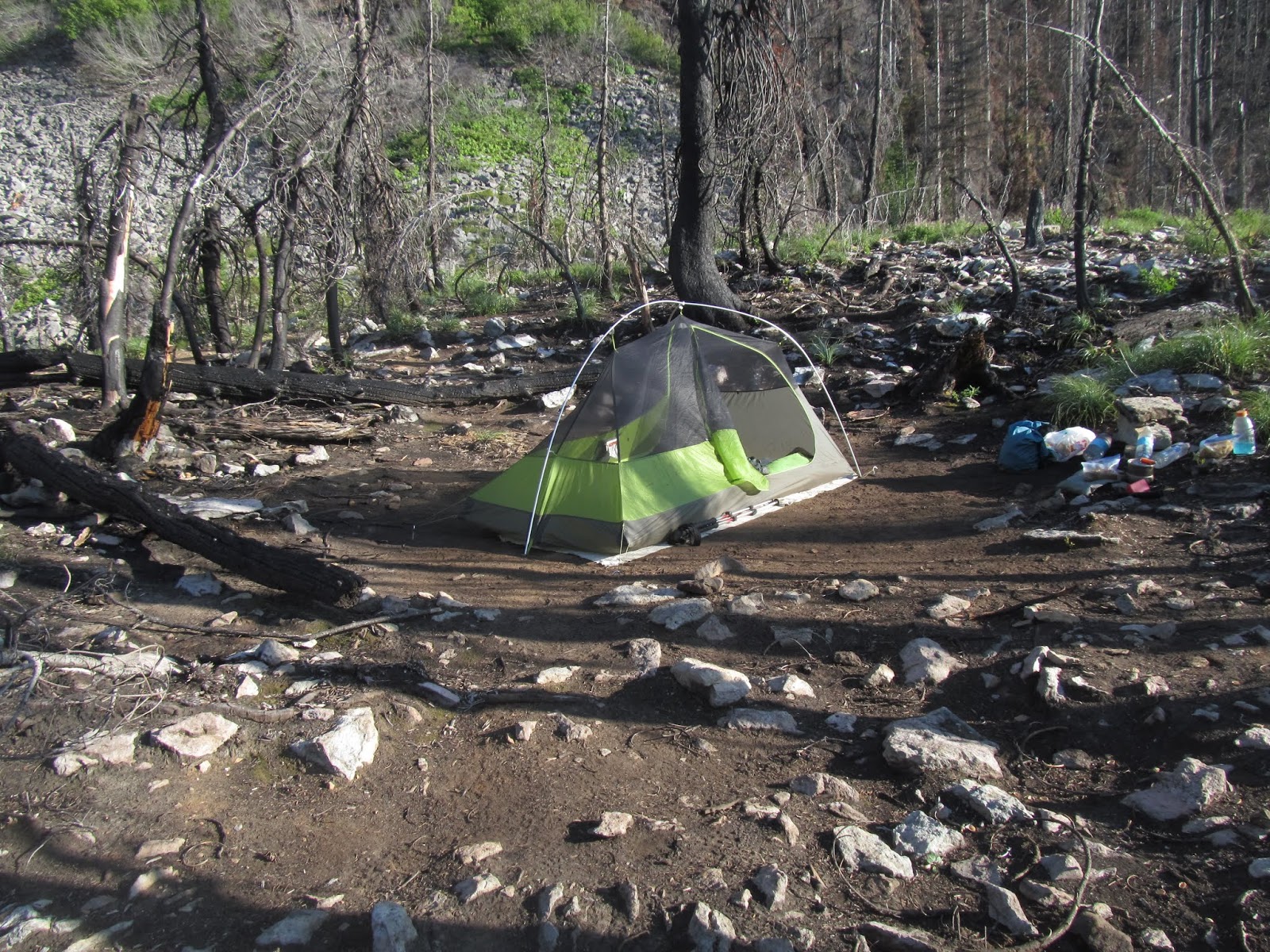
I hiked 19 miles from Bridge of the Gods (PCT mile 2144.4) to Rock Creek (PCT mile 2163.6)  I camped at Rock Creek with Northbounders, Southbounders, people who flipped past the Sierras.  I have no clue how many are camped here, but I'll guess a dozen anyway.  I had a sweet campsite away from everyone (both he and the other campers were pleased by this).

After feeling bad enough to end the trip, I am thrilled to still be in the game and moving up the trail.  Today hills, peaks above some elevation were in a cloud, mist or rain soaked the vegetation and made for cool but sloppy conditions.

Sun 7/28

The past three years with some 2,500 miles I have almost always been the first on the trail.  Not today.  Two hikers, Metric Ton, and someone else, came by my tent at 4:15 am.  Lazy me didn't hit the trail until 4:56 am.

Today's hiking started with a big climb.  My fresh legs did ok.  Then there was a fairly flat five mile section to Panther Creek. Folks at campground really pushed for me going to the campground to get to the water-spigots.  To get water, you have to pump like the dickens, water came out in a seemingly random pattern.  It would have been great with a partner--one to hold the bottle and the other to pump.  No way I could pump AND hold the bottle.  Highly inefficient as only 10% or less of the water ended in the bottle.

After getting water I started the second big climb.  Around 3:00 pm, I arrived as a road crossing, and then a water cache.  I wish I had known about the cache as I would have carried less water up the hill.  A couple -- Happy Bear and Lupine -- are staying here too.  Perhaps others as well.  My campsite is tucked away from the cache.  At an earlier cache I got an apple.  The apple was wonderful, bruises and all.

Started at Rock Creek PCT mile 2163.6, ended 2184.6 = 21 miles

Mon 7/29

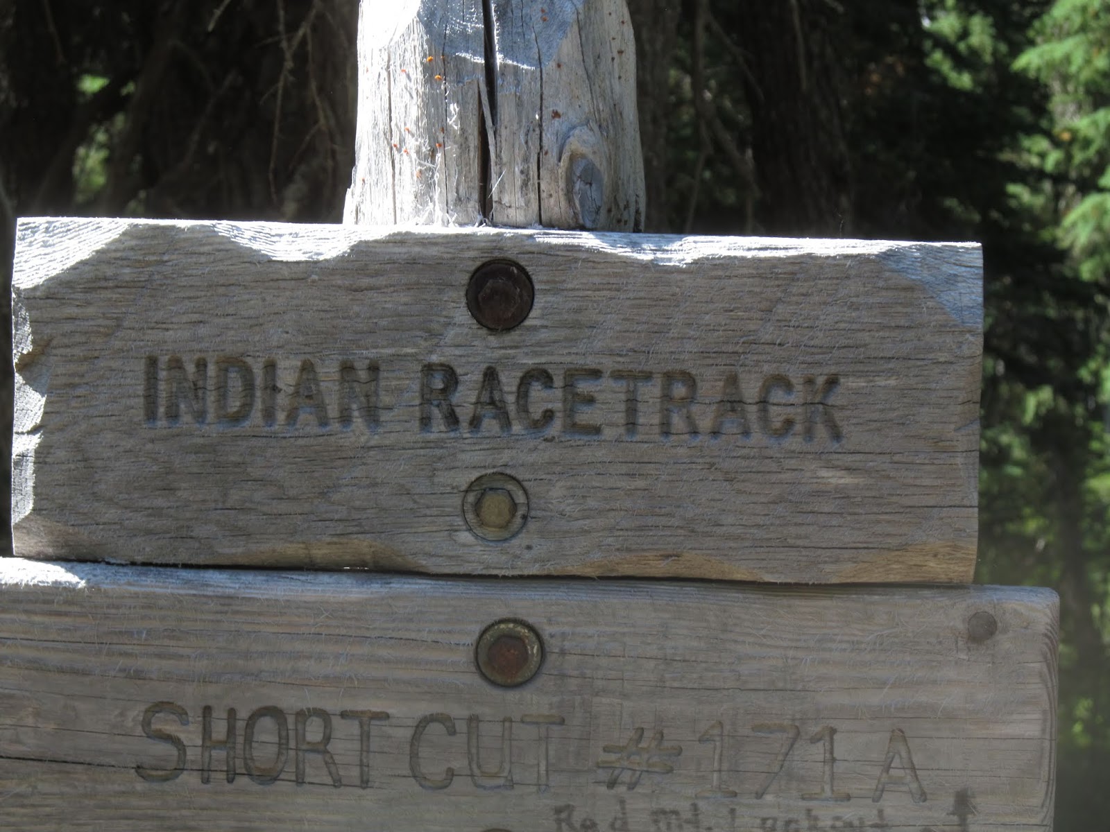
Left camp at 4:55 am.  First 4.4 miles was finishing the climb I started yesterday afternoon.  After the climb the hiking was pretty easy.  At mile 2199 I came to a sign for Indian Racetrack.  I did not go because years ago, Harold and I did this section, and we went to the racetrack.  Just a grassy meadow.  No Grandstand, no loudspeaker, no cheering fans.  Very quiet and unassuming.  In its prime I'm sure the Indian Racetrack was grand and exciting.

Sometimes the Heart Wins

On a hike like this my head and my body are in lock-step--more miles, just one more mile.  Today my heart won.  Approaching Bear Lake was a young couple debating whether or not to camp at Bear Lake.  Time was 2:48 pm--plenty of time to hike 5 or 10 more miles.  But my heart said, "We've been pushing.  Bear Lake is gorgeous.  It would be a shame to push on." I'm camping at Bear Lake.  I just won't get to Trout Lake as early tomorrow.

Southbounders

Southbounders start at the Canadian Border and hike south.  In most years there are only a few hearty southbounders.  NOT this year.  Because snowpack in Sierras and low snowpack in Northern Washington convinced a lot of hikers to go SOBO.

Southbounders are shooting for 2650 miles.  I'm only trying to do 1000 miles.  Funny thing--today I crossed 500 trail miles from California border, the southbounders still in Washington are at 400-450 miles.  My trip will be much shorter, but I've done more miles. Seems weird.

Started PCT mile 2184.6 -- ended Bear Lake 2205.7 + 21 miles.

What is Kevin eating? 

Long distance hikes are a calorie-deficit situation.  You are burning 5,000 to 8,000 calories.  You can't carry enough Trail Food, so you supplement with Town Food when you can.

What Kevin ate at Cascade Locks:
  • At the Ale House--salad, jalapeno hamburger, fries, Lager beer and ice water
  • At Gourmet Hot Dog and Ice Cream Shop--Reuben dog with sauerkraut, Reuben meat and cheese.  Also huckleberry ice cream in a waffle cone. 
  • Saturday morning = Breakfast burrito
  • At Trout Lake - I understand hikers get very slow service.  My resupply is at Trout Lake Grocery, so I'll get food there. 
Breakfast
  • My body knows it gets fed at 6:30 am
    • 6:30 Sunrise Energy Bar from Costco--oats and seeds
    • 7:30 Nuts
    • 8:30 Main Breakfast--oats, multigrain muesli or Grape Nuts with raisins, craisins and milk powder (a mix of whole and non-fat mixed)  Main breakfast goes in a freezer bag.  Add water, stir, and eat
Dinners in a freezer bag
  • Mexican--meat dish dehydrated (carne adovado, green chile, red chile) and Spanish rice (I cooked and dehydrated) and dehydrated refried beans (Pinto, of course).  Also add a packet of olive oil
  • Non Mexican--have done roast beef, spaghetti sauce and hamburger, pulled pork, Texas BBQ Brisket, alfredo with ground turkey.  To non-Mexican meals, add dehydrated  veggies (from Karen's Naturals), pasta (Whole wheat macaroni)
Pour hot water into freezer bag, stir, wait 15-20 minutes. Add Fritos to Mexican dinners; eat non-Mexican with Wheat Thins.

Pre-Dinners/Lunch

Peanut Butter with Wheat Thins or Wheat Thins with dry Italian Salami and Gouda cheese (encased in wax)

Between Breakfast and Dinner

Variety of granola/energy bars
Nature Valley--Oat n Honey, Protein Bars
Pure Protein bars
Clif bars
Kirkland nut bars
Kind Dark Chocolate and Cherry
Snickers
Pro Bars (1 per section)

Lunch stop: Wheat Thins with peanut butter or salami and cheese

Tues 7/30

Left Bear Lake 4:57 am, hiking in a cloud.  Good hiking, the miles rolled by pretty fast.  There was a 1,000 -  2,000 foot climb that went ok.  I was at Forest Road by 1:15 pm or so

More to come soon.

Saturday, August 24, 2019

WA/OR PCT Part 7

Mon 7-22 Day 17

Left miserable, dirty camp about 5:15 am.  Big climb (about 3000 feet).  Russell Creek crossing was a little dicey.  No way to cross without getting my feet wet.  Oregon PCT may be relatively flat, but dog-gonit, most of the day was slow going with gnarly rocks and tree roots.  And in places, big steps to take.  Also quite a bit of snow.  Jefferson Park is very scenic.  At 3:30 pm I finally hit the 20 mile mark. At Ollalie Lake, a Trail Angel was offering to cook a hamburger.  I really wanted the hamburger but passed to see if I could pull 25 miles.  I did, about 5:45 pm

I did the math.  If I didn't pick up the pace, I would not make Cascade Locks in time on Friday to get my resupply boxes, which also includes new shoes.  The lava rock has done a number to the shoes I've been wearing. 

I have encountered the same thing three times now.  I'm hiking along when suddenly, I am in the middle of a swarm of butterflies.  They are orange, black, and white.

I've run into a young woman from Kentucky.  She lives in Utah now and really loves the west.  Her trail name is Scrappy.  I bet you can guess how she got her name.

7/22: PCT mile 2029.5 - Lemiti Creek PCT mile 2054.6 =25 miles  Tomorrow I'll pass the 400 mile mark. 

Tues 7/23 Day 18 Lemiti Creek  PCT mile 2054.6 to PCT mile 2082.5 = 28 miles.

A lot of today was easier hiking.  Not gnarly, not very steep most of the time.  Also today, no unsigned intersections.

I have grown weary of pushing my body to hike more miles than I am in shape for.  I am 14-15 miles from my next resupply (Timberline Lodge) and 62 miles from Cascade Locks, which I must arrive by 4:00 pm Friday.  Two days in a row I have missed out on "Trail Magic" so I could push the miles.

Realistically I am in shape for 20-22 miles a day.  Nine of the last ten days I've done 25-28 miles.  I need to push for the next two days so Friday is easy and getting to Cascade Locks by 4:00 pm is a snap. 

My general goal of 1000 miles in 50 days is a no-brainer.  That would have put me home by August 25.  But when I look at getting home before Garrett comes (he was supposed to have come to Washington to work for a month around August 18) or even in time for our anniversary (August 15)--the miles have to be around 25 daily and no wiggle room.  In Cascade Locks, I'll call Becky and give her an alternative plan that looks promising, but has more logistics

My "Hiker Hunger" is kicking in.  I eat a good supper between 6:00 and 7:00 pm, but by 8:00 to 10:00 pm I am digging into my food sack for Fritos or a granola bar.  Here's tonight's example:

  1. Wheat Thins with peanut butter
  2. Roast Beef dinner 
  3. I polished off all the Fritos and Wheat Thins
  4. I just ate a Snickers bar, Kirkland Nut Bar, and a Nature Valley Oat and Honey bar
Wed. 7/24 PCT mile 2082.5 to Trail side stream PCT mile 2106.7 = 24 miles

Hiking was not bad early.  Had a first view of Mt Hood.  Then as I got closer to Mt Hood, the hiking was harder -- uphill in loose sand. A hiker going south said "Timberline Lodge is just around the bend."  She was correct, but way wrong at the same time. When I saw the Lodge, it was on the other side of a big canyon and it was another mile hiking on the contour of the hill. 
I ate at the lodge--very good, but quite expensive.  For that much money, Becky and I both get a meal.  

When I resumed hiking (12:30), it was okay, BUT there are MANY trails, mostly unsigned.  Difficult to stay on the PCT.  Other PCT hikers had the same issues, but they are using Guthook's app. 

Thurs. 7/25 PCT mile 2106.7 - Indian Spring Campground PCT mile 2125.1 =18.8 miles. 
Hiking went well in the morning and awful in the afternoon.  The past three years, I've done 2500 miles.  Today is the ONLY time after a break that I went the wrong direction.  Hiking along a ridge with almost unvaried tree canopy and underbrush.  I came onto "Squeaky" and found I was going south, not north.  So not as many miles today as I wanted, but I did get in a few "Bonus Miles." All you can do is grin and bear it. 

Six hikers are here--2 from England going south, 2 from Germany going north, Squeaky and me also going north.  

It was nice having people to talk to this evening.  But I should be another three miles up the trail. 

Fri 7/26

Left camp before 5:00 am.  My goal is to get to Cascade Locks before 5:00 pm to get my resupply box.  At Wahtum Lake, an unsigned junction, a lower trail is going around the lake and an upper trail.  Generally, the lower trail is just for access.  Not this time -- the lower trail was the PCT

Then there was a steep, gnarly down-hill section.  I'll take uphill over steep downhill any times.  My knees were screaming at me.  Last few miles were not bad.  Arrived at Cascade Locks at 1:00 pm
Maybe it's the let down after finally arriving but I felt awful.  Town food, shower, resupply boxes, laundry were good but I still felt awful.  I had full intentions of ending my hike at Cascade Locks.  

Sat 7/27  Walking to Bridge of the Gods to take photos of "Entering Washington" sign to show I had officially completed Oregon.  Leaving motel with a considerable limp.  Before reaching the bridge, I said, "Hey, I feel ok!"

I am moving on to Washington.  Plan is to take it one section at a time and to be a little more kind and gentle on Kevin.  

See you up the trail, amigos!


Friday, August 23, 2019

WA/OR PCT part 6 (I think)

Fri 7/19 

Heavy dew, so I pack up tent wet two days in a row.  Camp at Sisters Mirror Lake was nice but buggy--lots of mosquitoes.  Hiked through sub-alpine patches of forest:  Alpine Fir and sparse parks (alpine Lapine, Lomatium, sedges) and in the distance--meadows.  One hiker called today "Diverse," and it was.

Entered an "Obsidian Limited Entry"--no camping without special permit.  I have been with soil scientists or geologists.  There would be "Whoa! Obsidian!" There is so much obsidian in this area, it is ridiculous. Then into lava fields.  In places the trail was very steep and gnarly from all the loose rock.  Around a corner to the Minnie Scott Spring--ice cold water bubbling from the ground.  Wonderful! I loaded up on spring water and passed a couple of lakes. Who wants lake water when they can have spring water? The last 1.2 miles to McKenzie Pass a lava field.  Talk about an ankle turner.

Sisters Mirror Lake PCT mile 1959 to McKenzie Pass PCT mile 1984 = 25 miles.  I am really stove up. My knees ache.  I am very clumsy trying to walk.

At McKenzie Pass--2 cutie oranges, a banana, an apple, 2 cans of sparkling water from those who stopped at McKenzie Pass outhouse tonight.  I will bivvy on north side of outhouse--on a little strip of concrete.  There is no way I could hike three more miles north to the next campsite

Wonderful day! One bummer--I have shin splints in my left leg.  Never had shin splints before.

The bivvy behind the outhouse was not the best.  High winds plus it took quite a while to get settled.  Limited sleep.

Sat. 7/20

Most of the first two and a half of hiking was lava fields--gnarly ankle-turning rock.  SLOW going at best.  I thought it would never end.

I hiked the last few miles to Big Lake Youth Camp with a mom and her two sons.  They are hiking Oregon and have been on trail for four weeks.  Shower, rinsed out socks and shirt.

Big Lake Youth Camp was closed.  Saturday is their day of worship.  They left the hikers' hut open and resupply box was there.  Thanks, Becky!

McKenzie Pass PCT mile 1984 to Big Lake Youth Camp PCT mile 2004 + two miles to and from Big Lake = 22 miles.  Highly disappointing

Sun 7/22

The hike from Big Lake Youth Camp was hot and dry.  Yesterday I left Three Sisters Wilderness and today I entered the Jefferson Wilderness.

I'm north of the lava fields.  But whoever says Oregon PCT is flat can do what I did today:  PCT mile 2004 to PCT mile 2029.5 = 25.5 miles.  This section of trail was gnarly, rocky, and slow going.  Good news! I did 25+ miles.  Bad news: I had nothing left in the tank.


Cascade Locks post office is closed on Saturday and Sunday.  If I can do 25 miles, I can probably make it in time on Friday.  If I miss 5:00 pm Friday I will have to get my resupply box on Monday.  Food I can substitute, but the box at Cascade Locks is especially important as I am getting new shoes.


Phone App Gives Wrong Information

I'm hiking when the trail just doesn't look like the PCT.  No problem, turn on phone.  The HalfMile App says I am 0.16 mile off the PCT.  I back-track and the distance goes down to 90 feet, but then gets farther off.  The phone is responsible for a BONUS 0.33 miles.


Monday, August 19, 2019

Oregon->Washington PCT part 5

Tues July 16 PCT mile 1884-1907 + 3 miles to and from Shelter Cove + 1/3 mile = 26+ miles.

Shower and laundry at Shelter Cove. Also charged phone.  Tim made it to Shelter Cove about  1 1/2 hours after I did.  He is spending the night there.  I got back on trail and up it maybe 1/3 of a mile to a campsite that overlooks the lake.

Note to readers: When I am hiking I can think of many things to write about, but at the end of the day when I am tired it's a different story.  Today (7/17) was no exception.

Wed 7/17 Day 12 mile 1907 near Shelter Cove -> 1933 = 26 miles

Pushing the Envelope
My next resupply stops are Big Lake Youth Camp, Timberline Lodge, and Cascades Locks.  Most of my resupply stops are at resorts, camps, etc., and it doesn't matter when I get there.  But the post office at Cascade Locks is a different story--the post office is only open Monday thru Friday 9:00-5:00 and closed on Saturday and Sunday.  I've been doing the math and calculating my arrival.  I need to do a minimum of 28 miles per day to ensure Friday arrival.

How's the Body Holding Up

  • Back--mostly great (Thanks, Dr Bedford).  It does get tired carrying a pack most of the day with very few breaks.  
  • Knees--okay during the day.  They ache at night, but by morning are ready to go. 
  • Feet--two blisters showed up today.  Left foot on outside of heel below the ankle, Right big toe in a spot I cannot see.  
(Note:  as of 7/22 six of the last seven days have been 25-26 mile days. 

One Mis-step away from Disaster

At an estimated average of 2500 steps per mile, a lot of steps are taken on a 20-25 mile day.  Turns out I am camped near a young woman.  Her name escapes me.  Yesterday she twisted her ankle on a tree root and fell.  Today was a zero-day (no hiking) for her.  She has been going NOBO, but will head south tomorrow.

Why do we stumble or fall? 
  • Inattention to where we are stepping
  • Failure to raise foot high enough to clear obstacle (curb, rock, root, etc)
  • We are tired
  • Distracted. 
On the trail there are four types of obstacles--Rockers and Rollers, Trippers and Slippers.
  • Rocker--shifts front to back or side to side when you step on it.  You can lose your balance, stumble, or even fall
  • Roller--rolls when you step on it--rock, part of tree branch
  • Tripper--just a little or several inches higher than the ground--rock, root, curb, etc.  You stumble and even fall. 
  • Slippers--or slip or what? Whatever is underneath, your foot slips--
    • wet rock, wet wood without bark, ice, snow, some slippers are a frictionless surface--You cannot stand on it: such as algae on a rock in a stream crossing, Ice on wood, sheen of water on ice.  
Thurs July 18  Hiked from Brahana Lake (PCT mile 1933) to Sisters Mirror Lake (PCT mile 1959) = 26 miles

It rained a little during the night.  When I stepped out of the tent, there was a slight drizzle.  So I put on my rain coat and pants.  Ten minutes up the trail it stopped, so I took off the rain set and put on wind breaker.  Later rain gear went back on.  Later yet, we had sun and rain gear came off again. 

Mosquitoes were not bad to horrible.  At camp I had to do some business with my shorts down.  Those pesky mosquitoes must have bitten both cheeks in ten spots.

The Sierras
I have found two hikers that made it through the Sierras.  A lot of people remembered 2017 when two women drowned.  Several said, "It's not worth risking your life for.  I skipped the Sierras and will go back after."