- At 10:00 AM I went to the post office--my resupply box was there.
- Bummer--waiting for post office to open. I missed shuttle rides to trailhead at 6:00 and 7:00 am
- Guy named Brian picked me up at 11:30 and I started hiking at noon.
- Hiking UP Kearsarge Pass is 3000-3500 feet of elevation to climb
- Ran out of gas/energy to climb over Glen Pass to climb over Glen Pass too
- Camped at PCT mile 790, about one mile shy of Glen Pass
- I was bummed at missing the early shuttle rides, cause I know I'd have made it over Glen Pass.
The Trail/God Provides Again
- A hiker liked my campsite and took a photo. I did too.
- Around 6:00 pm, I heard, "NO WAY!" I looked up to see Carsten. We hugged and darn near did a happy dance.
- We talked and talked--Carsten told me all about summiting Mt Whitney, and I told him about my stay in Independence. I cannot begin to tell you how much I like Carsten.
- We left camp at 5:30. By 6:30 we were on top of Glen Pass. It felt like we were on top of the world--3000 feet and incredible views
- Breakfast, photos, and several "Can you believe this?"
- The way down Glen Pass was steep, rocky, and hard going.
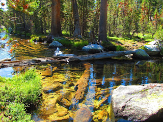
- Hiking the rest of the day was hard--steep up or down, big steps, rocky, lake crossings and stream crossings. Other than wading barefoot at one stream crossing, I never got wet once
- Carsten wanted a long lunch break. I felt I'd better make tracks. So we hiked solo in the afternoon
- The suspension bridge over Woods Creek swayed and bounced with every step
- Then I started the long toward Pinchot Pass. The climb to the Pass is some 3500 feet. After doing Glen Pass and all the hard hiking I had no idea how far I'd get.
- I just try to be steady and slow, and get into a rhythm, step after step. Keep plugging away. I check my altimeter watch every half hour to be encouraged by my progress.
- The maps showed water at PCT mile 806. Carsten's info showed a campsite.
- At PCT mile 805.55, below the trail I saw water and possibly a bivvy site. And I saw nothing promising ahead.
- Water secured and tent set up, I cook dinner--pulled pork and even McClard's Barbecue sauce. Thanks, Becky! I stood up and BINGO! -- there's Carsten on the trail above me.
- It is before 7:00 pm and in our tents--pesky moquitoes
- Knees are growling at me BIG TIME--way too much steep downhill.
- Started PCT mile 790 Ended PCT 805.6 approx 15.6 miles.
- There were very few easy miles. I had to earn darn near every mile.
Wed 8/30
- 6:45 am--we are holed up in our tents trying to let the rain pass.
- Finally left camp at 7:15 am (one hour and forty-five minutes late for me.)
- Made it up and over Pinchot Pass with Carsten
- During the day, the weather changed frequently--rainy to sunny
- I put on pack cover and rain gear multiple times.
- Carsten needed a long lunch break, so I moved on climbing Mather Pass and making my way to lower Palisade Lake solo
- Carsten made it to campsite about 6:00 pm
- Started 805.6 Ended 820.5 about 15 miles
- People coming down Mather Pass kept talking about snowbanks. I had far more problems with loose rock than snow
- I could not believe how many people were camped at Lower Palisades Camp. A woman showed me a campsite amongst shrub willows
- About an hour after I arrived at Camp, Carsten camp in.
- We left camp at 5:30 am. I love hiking early--you've got the trail to yourself and you get to see sunrise develop
- At one point we were passed by an older couple. First time this happened the entire trip (being passed by folks approximately my age)
- Both Carsten and I noticed something odd--the man never looked back to see if his wife/friend was doing ok. It didn't matter if there was a downed log across the trail, a stream crossing, or a steep uphill. He just kept on hiking.
- This made us angry, so we passed them back.
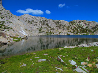
- We hiked a long time in the alpine zone--no trees, mainly rock and lots of streams and lake
- We camped at the very last campsite below Muir Pass, elevation 11,300 feet. We had a a dry spot with grass
- Beautiful view, but a totally exposed campsite. If bad weather hits, you are at the mercy of the weather
- A guy named Jason joined us. Jason was upset with his partner, a Japanese man. The Japanese man was nowhere to be found and he had their stove. This left Jason with no way to cook his dinner. I let Jason use my stove and cooking pot.
- Jason is somehow helping Locus Gear market their cuben fiber tents
- Around 7:30 pm, a thunderstorm was pounding the mountains east of us. Carsten asked where we would go if the storm hit us. I said, "Nowhere. We stay in our tents on the sleeping pad."
- We had nowhere to run or hide
- About 8:00 pm, it rained for a bit and quit. I thought we were out of the woods, so to speak. I was wrong.
- About 10:00 pm, rain and wind hit us hard. We stayed dry but my hiking shoes, which were just outside the tent in the vestibule got soaked.
- The night was cold. Besides base layer, socks, and stocking cap I wore wind jacket and gloves
- Started PCT mile 820 Ended at 837 about 17 miles
- We waited until 6:42 to leave to make sure we could find the trail as it crossed snowbanks and streams.
- Snow started out hard. On the very first section of snow, I used microspikes.
- We crossed multiple snow fields and streams and climbed steep, rocky sections.
- Muir Pass has the coolest stone hut. We enjoyed the hut as it was windy and cold at the Pass.
- How am I doing? my back hurts late in the day (one reason I stopped early today), my knees ache at night, I'm frustrated at only doing 15 miles per day in the Sierras, I want a shower and clean clothes, I want to sleep in a bed. In short, I'm loving every minute. The Sierras have tough miles but BIG rewards.
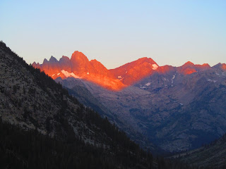
- I've now seen a big section of the Sierras. Here are a few descriptive words:
- stunning
- jaw-dropping
- beautiful
- amazing
- awesome
- incredible
- beyond belief
- wonderful
- Post Card beauty
- Neither words nor camera can capture what I'm hiking through. I am so blessed to be here.
- Solo again
- I have experienced many miles of hiking alone and also many nights of camping alone on this trip.
- Carsten wants to experience "alone time." Reasonable request
- We both enjoy each other's company, but I left when Carsten was on an extended lunch break
- Started PCT mile 837 ended mile 852 about 15 miles
- Left camp at 5:21 am
- Two Falls Same Day
- While it was still dark, within a few minutes of camp, my right foot caught a root and down I went. No harm, no foul
- Later in the morning, I stepped on a rock that was steeply angled. Down I went again, but this time I lost a little hide on my right shin
- This caused me to lose a little confidence with the next 2-3 stream crossings.
- Came over Selden Pass about 12:15 pm. Same beautiful wonderland as the other passes. If you like alpine and sub-alpine zones, the Sierras are "eye candy"
- Started PCT mile 852 Ended 873.6 about 21.6 miles
- I'm so glad to finally pull a 20 mile day again.
- Camped with Chris. Campsite had a wonderful seasonal stream nearby--flowing over a rock for easy water.
- Chris and I talked "hiker talk" and then I hit the sack. I need an early start to make sure I'm at the dock for the ferry tomorrow morning.
- Started hiking at 5:25 am. Needed my headlamp for 5-10 minutes
- The trail from camp began steep and rocky. But after awhile the trail became smooth and much more level.
- I cross the steel bridge over Mono Creek and then took the trail to the ferry landing.
- VVR--Vermillion Valley Resort--has a system: they start a tab for ferry ride, food, shower, etc
- Big Time Bummer! My resupply box is NOT here! VVR is a resort on National Forest land and needs more time for a mail delivery
- I can get by without the food by just using the hiker box.
- But I absolutely need the maps from VVR to Tuolumne (PCT miles 878 to 942). From other hikers going South, I've scrounged map from 878 to 916. If I took off now I'd be hiking "blind: the last 26 miles.
- Passes I have crossed several mountain passes in the Sierras
- Forester: highest at 13,000 feet plus
- Glen, Pinchot, Mather, and Muir are about 12,000 feet
- Selden is almost 11,000 feet
- Glen Pass was very steep coming down north side
- Muir Pass was the most sporty--several snowfields and stream crossings that were a challenge. Combined with the stone hut, Muir Pass was fun!
- Perspective: the PCT in Washington and Oregon does not get much over 7,000 feet.
- I made several calls to Becky and left messages concerning my resupply box tracking number. She doesn't answer calls from numbers she doesn't recognize.
- Calls were made on VVR's satellite phone. They use a timer to know how much to charge the customer (me)
- About late afternoon, I no longer cared about the resupply box. Now I had a much bigger concern--something was wrong with Becky. I was prepared to end my hike and skedaddle home.
- Finally I left a message with Garrett. I was pacing up and down like a cat.
- Becky called and she was ok (in my defense, my phone no longer notifies me if I have a voice mail message.) And my box was delivered on Wednesday.
- Sure enough the box was there. But I had planned to leave today on the 4:00 pm ferry. Grrr!
- I'm much relieved that Becky is ok. I can continue my hike as planned.
- I am pleased my priorities shifted from resupply box to Becky.
- Tomorrow I'll be on the 9:00 am ferry, make my way back to the PCT and point my footsteps northward toward Tuolumne and home.
- I have a sense of urgency to tie in my steps and get back home.


A few thoughts:
ReplyDelete1. Its easier to hike with someone when part of the day you split up. It was rare for me to hike with someone all day and generally, I found myself not hiking with that person soon after.
2. The High Sierras are the best part of the trail in my opinion. Starting at Mt. Whitney and ending with Muir Pass is the absolute highlight of the trail. It's still stunning all the way to Sierra City so Dad will enjoy himself even though he finished the best part.
3. In the section between VVR and Tuolumne, you cross Silver Pass and Donahue Pass. Those two passes are known for being tricky to navigate. If there is one section of the trail to have a map, this is it.
Looking forward to seeing you at home Kevin, but what spectacular country and views!! Praying for you!!
ReplyDeleteLove your pictures and narratives. What an adventure!!!
ReplyDeletenice post
ReplyDeleteI can only imagine how remarkable and adventurous this trip might have been. It’s beautifully narrated. These pictures are incredible as well. Thank you for sharing such a wonderful experience
ReplyDeleteYour boots are the foremost critical element which affects the enjoyment of hiking.browse this site For this reason you should pick the best hiking boots for your needs.
ReplyDelete